Ritik Tomar
Visionary, Coder, Explorer......
About Me
I am Ritik and I expect to assemble a vocation with Geo-spatial innovation and I am capable in
various GIS
programming and Remote sensing ideas. Currently, I am pursuing Under-Graduation in Engineering from
University
of Petroleum and Energy Studies. I am a solid expert with a
B.Tech Geo-Informatics centered in Geology/Earth Science and I am prepared to acknowledge demands
and a
wide range of obligations so as to upgrade my insight.
My key competencies in the field of
Geospatial technology are ArcGIS, QGIS, Remote Sensing, ILWIS, Subsurface Exploration both
Geological and Geophysical, Python programming language, Machine Learning with Python, Web GIS
Development.
Passion,
consistency, curiosity, adaptability and being fiercely loyal are my strengths. I am always
looking
for opportunities enabling myself to learn exciting technologies to boost my passion for Geospatial
Technology.
Birthday : 20 Aug, 2000
City : Dehradun, Uttarakhand
Mail : ritikchoudhary533@gmail.com
Hobbies : Coding, Gaming & Travelling
Languages
Python
Javascript
SQL
PHP
GIS RS Skillset
ArcGIS Desktop & ArcGIS Online
Quantum GIS
ERDAS Imagine & ILWIS
Google Earth Pro
Web Technologies
HTML
CSS
PostGIS
GeoServer
Education
2018-2022
University of Petroleum and Energy Studies, Dehradun
Currently pursuing Bachelor of Technology in Geo-Informatics
Engineering
focussing on the latest tools and technologies in Geospatial Innovation such as GIS, Remote
Sensing, GNSS and Geospatial Programming.
Apart from academics I am also part of various technial societies and student chapters
and also participated in various events and won quite a few.
2008-2018
D.A.V. Public School, Saharanpur, UP
Non-Medical Science with Informatics Practices
Secured an aggregate of 78.8% at All India Senior School Certificate Examination (AISSCE)
2018.
Secured 8.8 CGPA at All India Secondary School Examination (AISSE) 2016.
2004-2008
Delhi Public School, Saharanpur, UP
Experience
Jan, 2021 - Present
Student Placement Representative
I am representing my batch to the Career Services Department and
ensure seamless two way flow of communication between both the levels.
Also served as Class Representative for 2 years.
Apr, 2021 - Present
President, ThinkBig Data
Currently Serving as the President for the ThinkBig Data community, responsible for managing all the intercommunity activities, making decisions for the workflow of the community and supervising & guiding the members of ThinkBig Data community.
Sep, 2020 - Apr, 2021
Event Head, ThinkBig Data
Served as Event Head for the ThinkBig Data community for over 7 months and successfully organized and managed various Technical Events, Workshops etc. for the hollistic development of the community.
My Projects
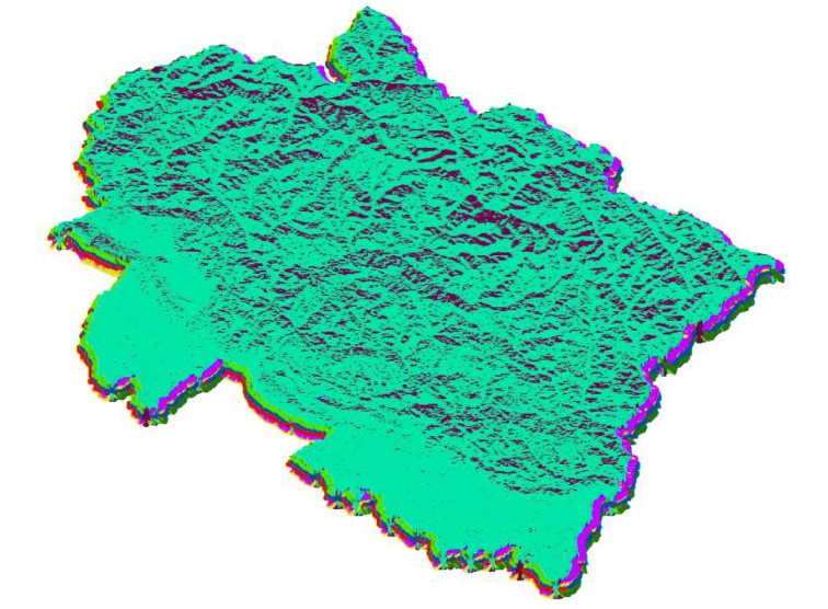
Watershed Delineation Mapping of Uttarakhand
Derived various Hydrological features with the assistance of GIS from the Digital Elevation Model of Uttarakhand state which can be used for various applications and decision making.
A dynamic Web GIS Application for Conducting Land Survey Activities
Built a Web GIS based WebApp has been built using the standard Web
Development approaches like HTML, CSS, JavaScript, PHP, Geoserver and PostgreSQL.
Main aim of this WebApp is to facilitate the surveyors and help them conduct surveys swiftly and
more accurately.
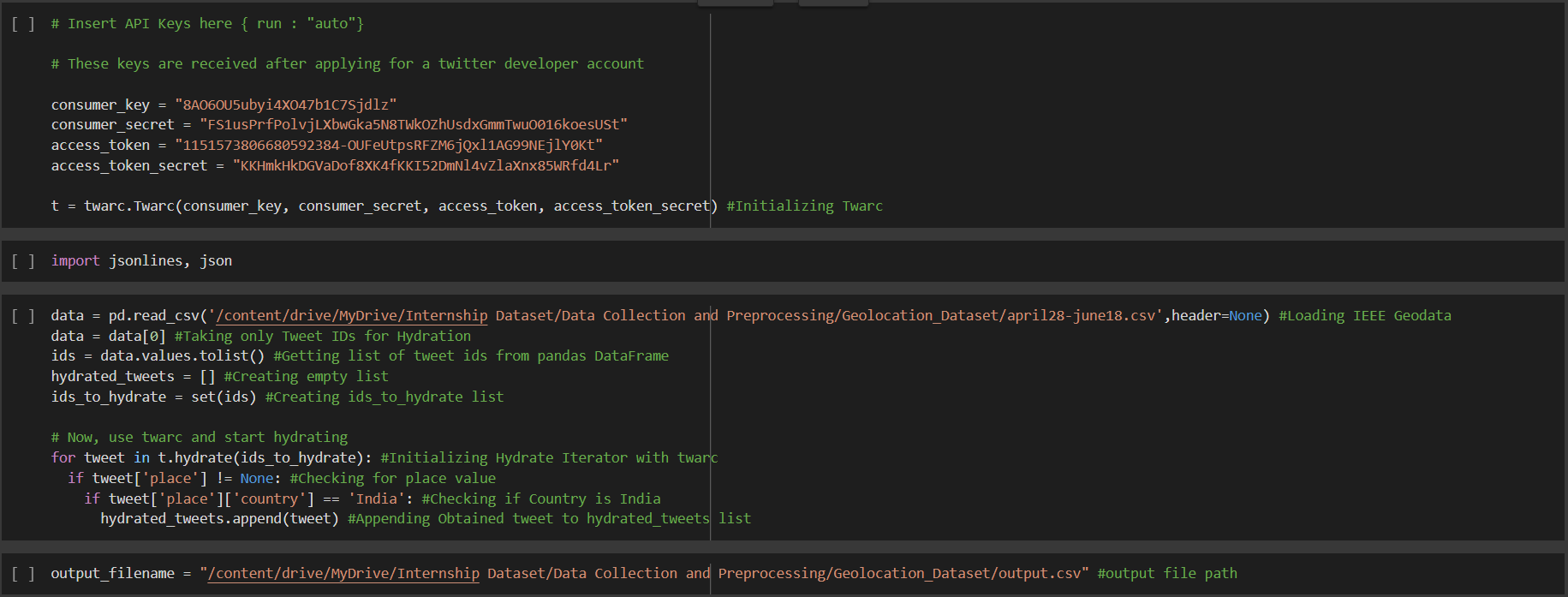
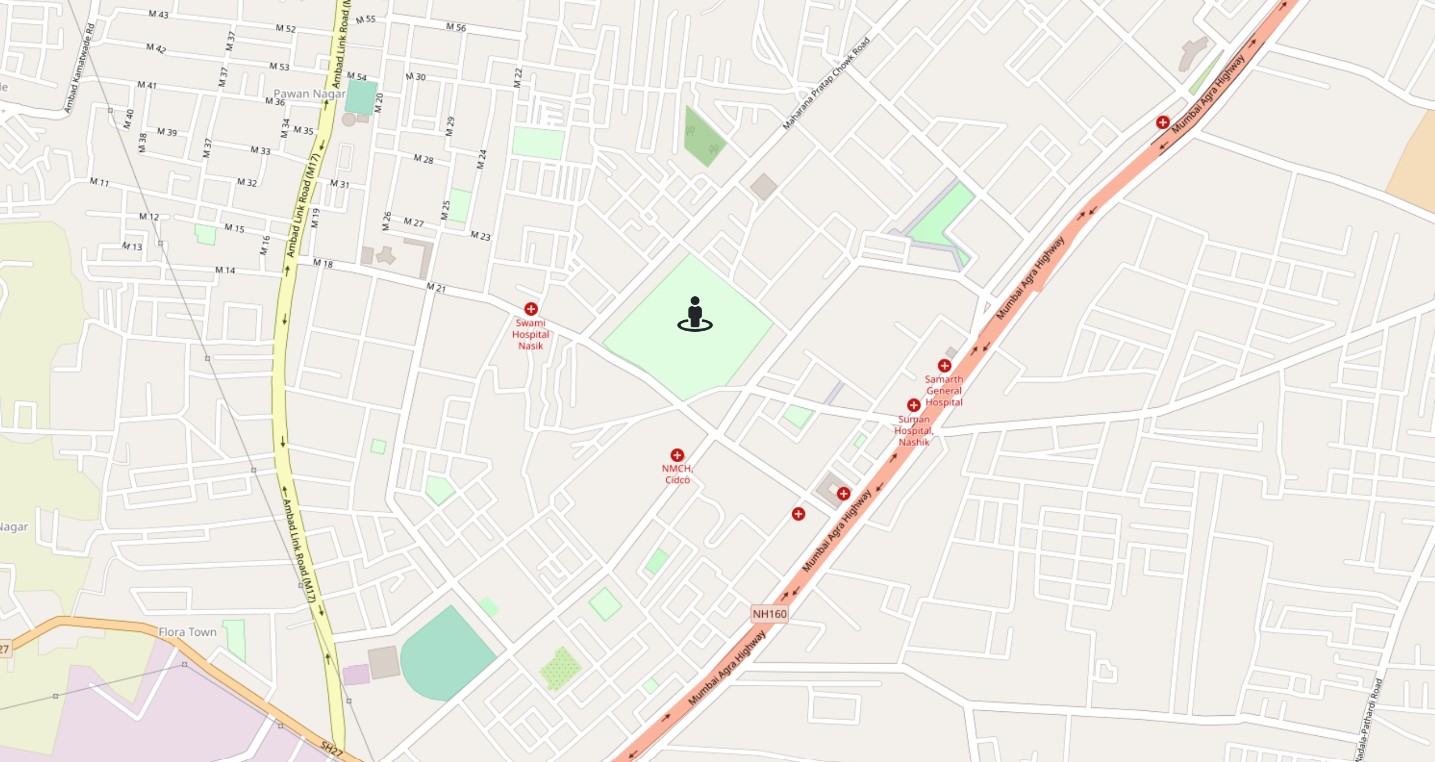
Location Based Twitter Sentimental Analysis and Extraction for COVID-19
This Project is based on Natural Language Processing and aims to build a pre-trained RoBERTa model to analyze the sentiments of tweets related to COVID-19. Further the coordinates of tweets were extracted by hydrating the tweets using a few line of code in Python and visualized on ArcGIS Online.
A Comparative Assessment of Burn Scars caused by Forest Fires in Chamoli district using Landsat and SAR Imagery
As a part of this project, Landsat-8 and SAR imagery from before and after the fires will be used for the visualization of burn scars. Further the damage will be calculated using the Normalized Burn Index and the feature class will be hosted on ArcGIS Online.
Contact Me
ritikchoudhary533@gmail.com
500068081@stu.upes.ac.in
+91 9917665883
Dehradun, Uttarakhand